A NSW Government website

Enhanced mineral potential data packages released

The Geological Survey of NSW has released 4 upgraded data packages that showcase NSW’s mineral potential.

Synthesising expert knowledge and geoscientific data using cutting-edge software analytical techniques, the mineral potential maps can be used to support strategic land use planning and decision-making.

They also provide a useful resource for improved mineral system studies and support potential new mineral exploration model generation.

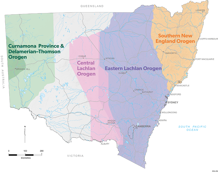
The data packages represent the results of mineral potential studies in each basement province of NSW:

  • Southern New England Orogen
  • Curnamona Province and Delamerian-Thomson Orogen
  • Eastern Lachlan Orogen
  • Central Lachlan Orogen.
Map showing the study areas for each mineral potential data package.

The latest enhancements allow industry stakeholders to better interpret and use the data, with the files made more accessible and user friendly and additional file formats added.

The data packages include GIS files for training points, study areas, predictive maps, and mineral potential maps for each model, as well as a summary report.

Download the data from the DiGS portal: Southern New England Orogen, Curnamona Province and Delamerian-Thomson Orogen, Eastern Lachlan Orogen, Central Lachlan Orogen.
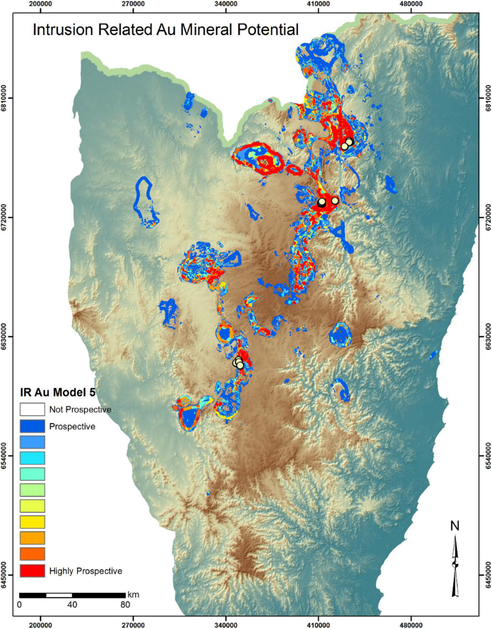
Intrusion-related Au mineral potential results for the Southern New England Orogen (extract from Southern New England Orogen mineral potential report).

Recent Articles

Exploration

The NSW Government is continuing to build momentum to unlock new mineral discoveries across the state, strengthening exploration through the

Photo of Vibroseis trucks used for seismic surveys

Geoscience

The potential in NSW for geothermal energy, a clean and sustainable source of power, is unveiled in new modelling undertaken by the

Thermal map of NSW showing variations in temperature from the top of basement

Geoscience

A new Quarterly Note published by the Geological Survey of NSW highlights the dramatic centuries-old history of the state’s metalliferous

Historic photo of vehicle and mine workers at Chesney Mine in Cobar