Geophysical images and data
New! Geophysical images of NSW for Android or Apple phones or tablets are now available.
Airborne magnetic, radioelement and elevation surveys
Airborne magnetic surveys measure variations in Earth's magnetic field due to magnetic minerals in the ground, principally magnetite and/or pyrrhotite. Radioelement surveys measure the surface distribution of the naturally occurring radioelements, potassium, thorium and uranium. Topographic elevation is measured by the aircraft radar-altimeter.
The NSW Government has been acquiring airborne magnetic, radioelement and Digital Elevation Model (DEM) data through various funding initiatives since 1991. These surveys were undertaken in partnership with Geoscience Australia under National Collaboration Framework agreements. Smaller surveys have also been flown over some coal basins as part of the Coal Resource Identification Program.
Previously, the entire state was covered at 1,500 m line spacing as part of the Bureau of Mineral Resources airborne geophysical surveying of Australia between 1951 and 1980. In some parts of the state this remains the only government magnetic and radiometric data, however, about 87% of NSW has since been surveyed at 400 m line spacing or closer.
You can download all NSW Government airborne survey located, grid and image data for free via MinView. Some surveys are also available through the Geoscience Australia Geophysical Archive Data Delivery System (GADDS).
Airborne magnetic, radioelement and DEM survey areas
Ground gravity surveys
Gravity surveys measure the effect of variations in rock density on Earth's gravitational field.
The NSW Government has acquired ground gravity readings across NSW, with about 71% of the state covered with 4 x 4 km or closer readings. Ground gravity data from across NSW can be downloaded for free via MinView or the Geoscience Australia Geophysical Archive Data Delivery System (GADDS).
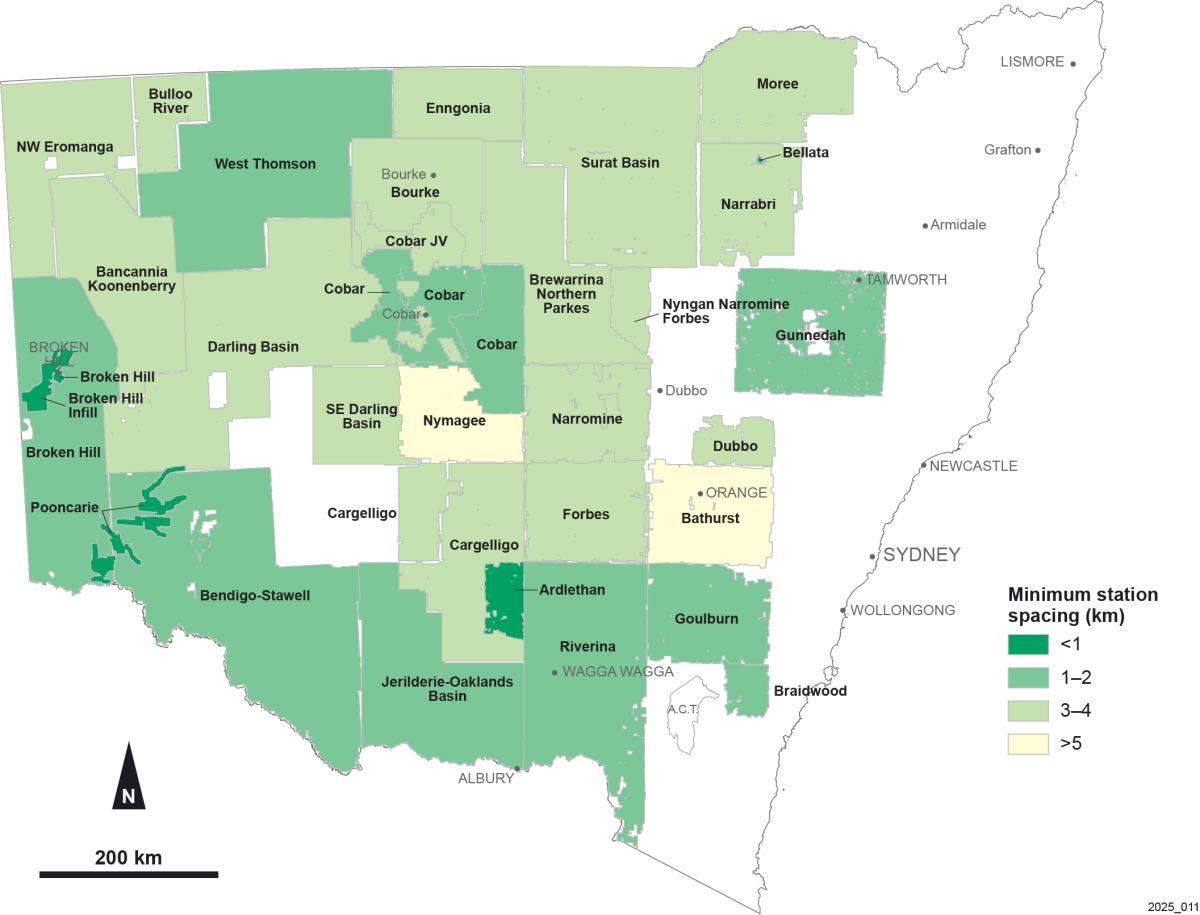
Location of ground gravity surveys
Airborne gravity surveys
Government-funded airborne gravity surveys have been completed over NSW. Data from these surveys can be downloaded via MinView.
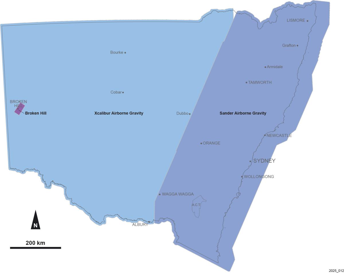
Location of government funded airborne gravity surveys
Airborne electromagnetic surveys
Airborne electromagnetic (AEM) surveys measure the conductivity of the ground down to a depth of a few hundred metres. Government AEM surveys have been undertaken in NSW and can be downloaded via MinView.
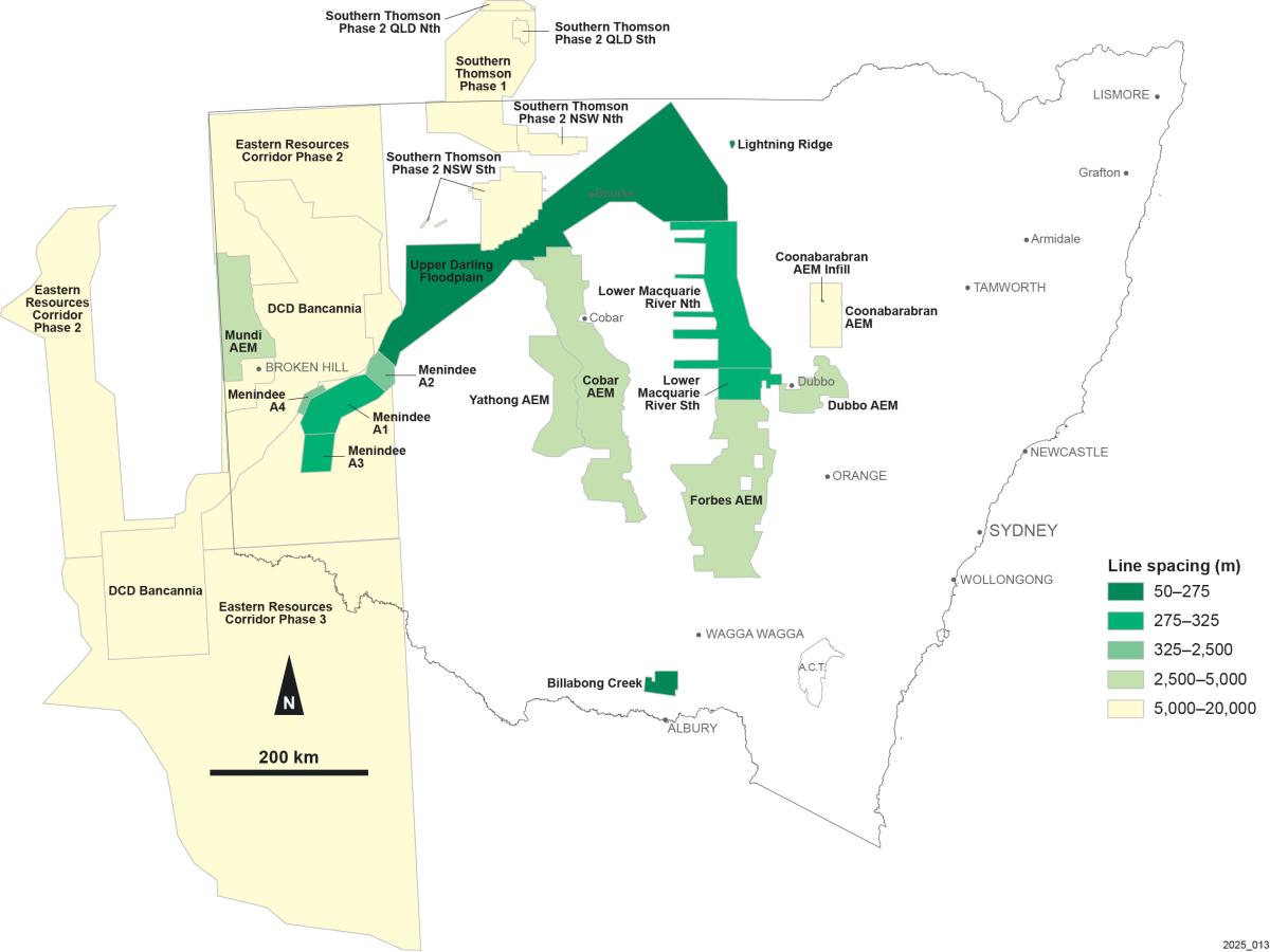
Location of AEM surveys
Hyperspectral data
Hyperspectral surveys measure natural electromagnetic radiation from the ground at visible to near-infrared wavelengths. Hyperspectral data has been acquired around Broken Hill and can be downloaded via MinView.
Location of hyperspectral surveys
Statewide geophysical grids
Government and open-file company airborne geophysics grids have been merged to produce statewide maps for the following data types:
-
Airborne magnetic merges (25 m grid cell size)
Updated biennially on even years. Last updated May 2024.
-
Airborne radioelement merges (25 m grid cell size)
Updated biennially on odd years. Last updated May 2025.
-
Airborne DEM merge (5 m grid cell size)
Last updated March 2023.
-
Airborne and ground gravity merges (500 m grid cell size)
Last updated November 2024.
All grids and images are available via MinView. Direct download links are also available below:
Magnetic
Total magnetic intensity (TMI)
TMI reduced to the pole (TMI RTP)
1st vertical derivative of TMI RTP (1VD TMI RTP)
2nd vertical derivative of TMI RTP (2VD TMI RTP)
Tilt angle filtered TMI RTP (TMI RTP Tilt)
Analytical signal of TMI RTP (TMI RTP AS) (available on request)
Upward continuation of 1VD TMI RTP (1VD TMI RTP UC250/UC500)
Elevation
All statewide geophysics grids can be downloaded through their respective metadata pages via MinView, as shown below:
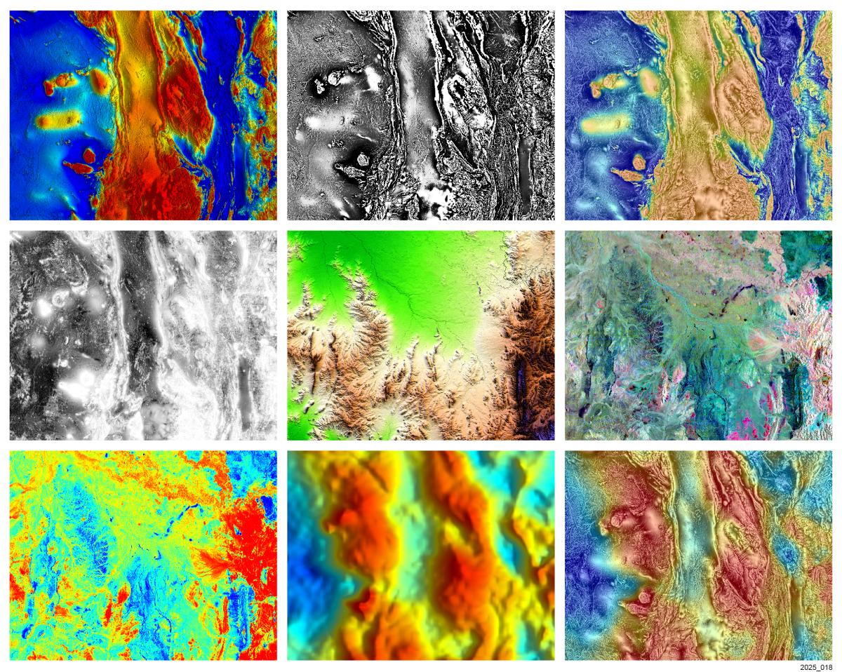
Statewide geophysical images
Images were generated from the statewide grids and are presented in pseudocolour, greyscale or ternary colour schemes.
Magnetic
Total magnetic intensity (TMI)
TMI reduced to the pole (TMI RTP)
1st vertical derivative of TMI RTP (1VD TMI RTP)
2nd vertical derivative of TMI RTP (2VD TMI RTP)
Tilt angle filter of TMI RTP (TMI RTP Tilt)
Analytical signal of TMI RTP (TMI RTP AS) (available on request)
TMI RTP over tilt angle filter (TMI RTP on TMI RTP Tilt)
Upward continuation of 1VD TMI RTP (1VD TMI RTP UC250/UC500)
Radioelement
Ternary image of potassium, thorium & uranium (KThU)
KThU on DEM
Thorium parts per million (Thppm)
Uranium parts per million (Uppm)
Thorium divided by potassium (Th/K)
Uranium divided by potassium (U/K)
Uranium divided by thorium (U/Th)
Uranium squared divided by thorium (U2/Th)
Dose rate (available on request)
Elevation
The statewide geophysical images can be viewed via MinView and downloaded from their respective metadata page.
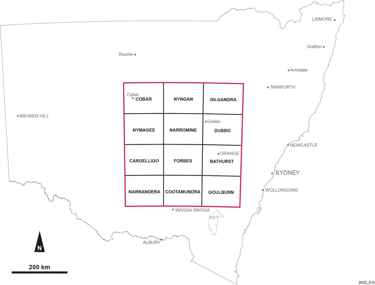
Central NSW high-resolution regional merge
The Central NSW (CNSW) merge spans twelve 1:250,000 map sheets. This region has high-resolution, open-file company data, is the grid cell size 10 m which is a 6.25× increase in resolution compared to the statewide products.
All grids and images in the CNSW package are available via MinView.
1:250,000 geophysical imagery suites
Suites of geophysical imagery were generated for each 1:250,000 map sheet area in NSW in 2014. Each image was generated using a colour stretch that enhances subtle features within the map sheet area. An update to this package is due for release later in 2025.
Each 1:250,000 image suite can be downloaded from MinView and contains over 30 images.
Open file company geophysical surveys
Exploration companies must submit geophysical data that they have acquired to the NSW Government to comply with reporting requirements. Surveys procured by exploration companies are usually higher resolution than government-funded regional surveys. the geophysical surveys are submitted with annual reports and indexed in the GSNSW database, which contains location and metadata for about 2,000 company surveys throughout NSW. The standard confidentiality period for most company acquired geophysical surveys is 5 years. These surveys can be searched via MinView, and downloaded if they are open-file.
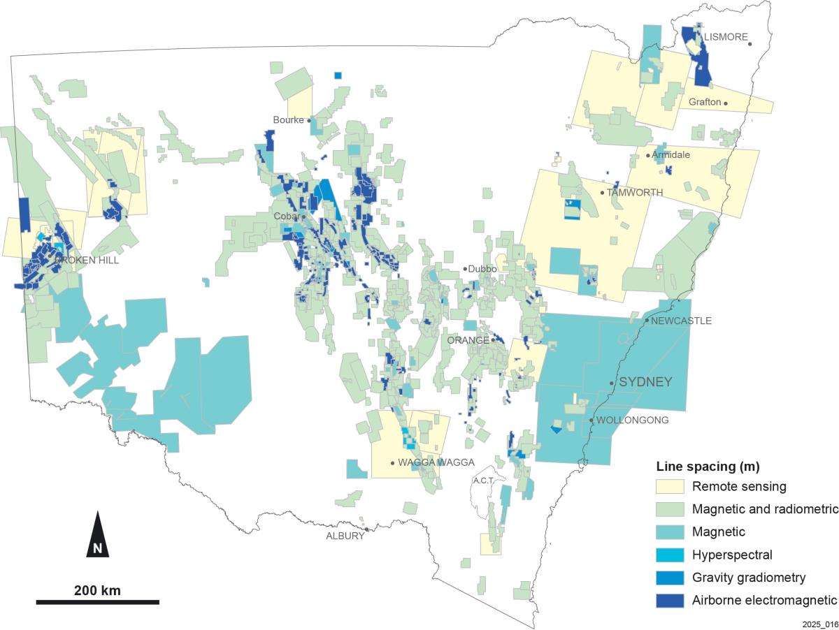
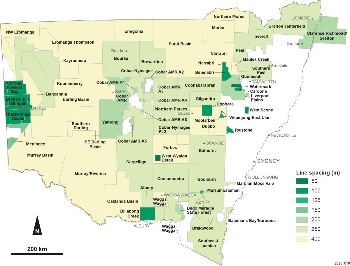
Airborne company geophysical surveys searchable in MinView
Seismic surveys
Seismic surveys support the study of the stratigraphy, major geological structures and tectonics. All available seismic line data for NSW can be searched via MinView. Downloads are limited to commonly used seismic files (such as seg-y’s), due to the large quantity and size of seismic files. Recent seismic surveys are more likely to have raw digital data and these files are multiple terabytes in size. If you require raw digital seismic data please email geophysics.products@regional.nsw.gov.au to organise access.
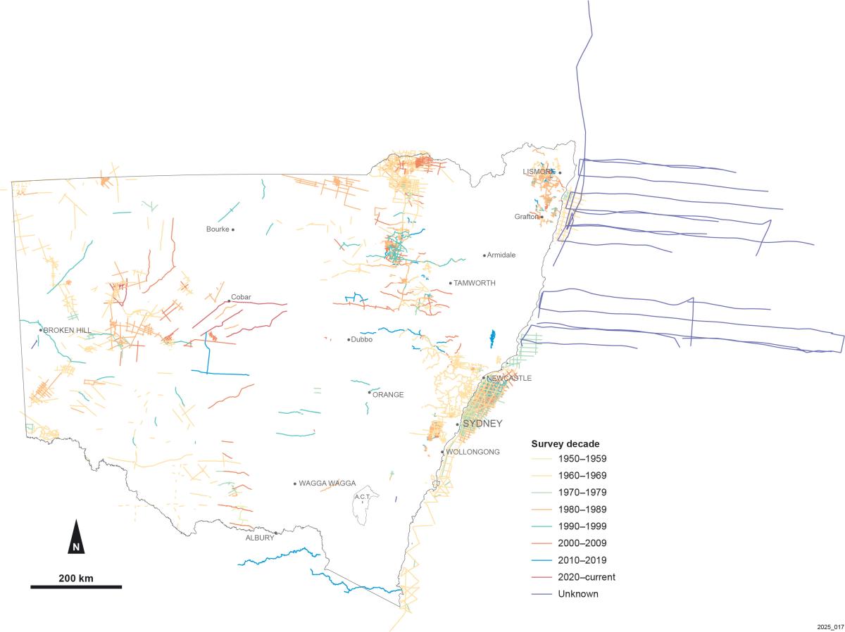
Seismic surveys for onshore and offshore NSW
For further information
Contact Geophysics Products