Geological maps
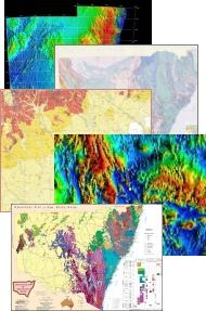
The Geological Survey of NSW publishes hard copy geological maps at several scales. The standard series maps are published at 1:250 000 and 1:100 000 scale, with the latter scale dominating current and future map products. Some 1:50 000 and 1:25 000 maps cover the Broken Hill and coalfields areas. More regional maps are printed at scales of 1:500 000 or more.
There is a near-complete coverage of the state at 1:250 000. Modern maps have good detail and comprehensive depictions of geology. However, sheets published prior to 1980 may lack the detail present in later maps. In addition to standard geological maps, the department has prepared a series of metallogenic maps depicting mineral occurrences and geology
Most hard copy maps are produced as a print run: however, high-quality, on-demand prints can be provided for early or provisional versions, out-of-print issues, or maps not scheduled for printing.
Many of these maps are accompanied by comprehensive explanatory notes which can be viewed in the DIGS® online report system or can be purchased as hard copy books. Where available, non-georeferenced images (JPEG format), georeferenced images (ECW format) and GIS vector data (ESRI Shapefile and MapInfo Table format) are provided as free downloads from DIGS®.
Available maps
1:25 000 geological maps
- Balaclava 1:25 000 Geological Map
- Brewery Well 1:25 000 Geological Map
- Broken Hill 1:25 000 Geological Map
- Campbells Creek 1:25 000 Geological Map
- Corona 1:25 000 Geological Map
- Euriowie 1:25 000 Geological Map
- Gairdners Tank 1:25 000 Geological Map
- Glen Idol 1:25 000 Geological Map
- Kinalung 1:25 000 Geological Map
- Lakes Creek 1:25 000 Geological Map
- Mount Arrowsmith Inlier 1:25 000 Geological Map
- Mount Browne, Mount Poole and The Gorge Inliers 1:25 000 Geological Map
- Mount Gipps 1:25 000 Geological Map
- Oakdale 1:25 000 Geological Map
- Pinnacles 1:25 000 Geological Map
- Purnamoota 1:25 000 Geological Map
- Redan 1:25 000 Geological Map
- Rockwell 1:25 000 Geological Map
- Silverton 1:25 000 Geological Map
- Stephens Creek 1:25 000 Geological Map
- Thackaringa 1:25 000 Geological Map
- Tibooburra Inlier 1:25 000 Geological Map
- Triple Chance 1:25 000 Geological Map
- Umberumberka 1:25 000 Geological Map
- Warratta Inlier 1:25 000 Geological Map
- Yalcowinna 1:25 000 Geological Map
- Yanco Glen West 1:25 000 Geological Map
1:50 000 geological maps
1:100 000 geological maps
- Araluen 1:100 000 Geological Map
- Bare Point 1:100 000 Geological Map
- Bathurst 1:100 000 Geological Map
- Berridale 1:100 000 Geological Map
- Blayney 1:100 000 Geological Map
- Bobadah 1:100 000 Geological Map
- Bogan Gate 1:100 000 Geological Map
- Booroondarra 1:100 000 Geological Map
- Boorowa 1:100 000 Geological Map
- Braidwood 1:100 000 Geological Map
- Brindabella 1:100 000 Geological Map
- Broken Hill Block Stratigraphic 1:100 000 Geological Map
- Bulahdelah 1:100 000 Geological Map
- Bunda 1:100 000 Geological Map
- Byrock 1:100 000 Geological Map
- Camberwell 1:100 000 Geological Map
- Canbelego 1:100 000 Geological Map
- Canberra 1:100 000 Geological Map
- Cargelligo 1:100 000 Geological Map
- Cessnock 1:100 000 Geological Map
- Clive 1:100 000 Geological Map
- Cobar 1:100 000 Geological Map
- Cobbora 1:100 000 Geological Map
- Cobham Lake 1:100 000 Geological Sheet
- Condobolin 1:100 000 Geological Map
- Coolabah 1:100 000 Geological Map
- Cootamundra 1:100 000 Geological Map
- Cowra 1:100 000 Geological Map
- Crookwell 1:100 000 Geological Map
- Drake 1:100 000 Geological Map
- Dubbo 1:100 000 Geological Map
- Dungog 1:100 000 Geological Map
- Euchareena 1:100 000 Geological Map
- Gindoono 1:100 000 Geological Map
- Gosford-Lake Macquarie 1:100 000 Geological Map
- Goulburn 1:100 000 Geological Map
- Grasmere 1:100 000 Geological Map
- Grenfell 1:100 000 Geological Map
- Gulgong 1:100 000 Geological Map
- Gunning 1:100 000 Geological Map
- Hillston 1:100 000 Geological Map
- Kayrunnera 1:100 000 Geological Map
- Kilparney 1:100 000 Geological Map
- Lachlan Downs 1:100 000 Geological Map
- Manilla 1:100 000 Geological Map
- Marsden 1:100 000 Geological Map
- Merriwagga 1:100 000 Geological Map
- Michelago 1:100 000 Geological Map
- Milparinka 1:100 000 Geological Map
- Molong 1:100 000 Geological Map
- Moss Vale 1:100 000 Geological Map
- Mount Allen 1:100 000 Geological Map
- Mount Arrowsmith 1:100 000 Geological Map
- Mount Oxley 1:100 000 Geological Map
- Mudgee 1:100 000 Geological Map
- Narooma 1:100 000 Geological Map
- Newcastle 1:100 000 Geological Map
- Nuchea 1:100 000 Geological Map
- Numbla 1:100 000 Geological Map
- Nymagee 1:100 000 Geological Map
- Oberon 1:100 000 Geological Map
- Olive Downs 1:100 000 Geological Map
- Orange 1:100 000 Geological Map
- Parkes 1:100 000 Geological Map
- Parkes Special 1:100 000 Geological Map
- Penrith 1:100 000 Geological Map
- Port Stephens 1:100 000 Geological Map
- Rankins Springs 1:100 000 Geological Map
- Sussex 1:100 000 Geological Map
- Sydney 1:100 000 Geological Map
- Tantangara 1:100 000 Geological Map
- Taralga 1:100 000 Geological Map
- The Meadows 1:100 000 Geological Map
- Tibooburra 1:100 000 Geological Map
- Torrowangee – Fowlers Gap 1:100 000 Geological Map
- Tullibigeal 1:100 000 Geological Map
- Tumut 1:100 000 Geological Map
- Ungarie 1:100 000 Geological Map
- Wellington 1:100 000 Geological Map
- Wollongong – Port Hacking 1:100 000 Geological Map
- Wonnaminta 1:100 000 Geological Map
- Woodburn 1:100 000 Geological Map
- Wrightville 1:100 000 Geological Map
- Wyalong 1:100 000 Geological Map
- Yancannia 1:100 000 Geological Map
- Yantara 1:100 000 Geological Map
- Yass 1:100 000 Geological Map
1:250 000 geological maps
- Ana Branch 1:250 000 Geological Map
- Angledool 1:250 000 Geological Map
- Balranald 1:250 000 Geological Map
- Barnato 1:250 000 Geological Map
- Bathurst 1:250 000 Geological Map
- Bega - Mallacoota 1:250 000 Geological Map
- Booligal 1:250 000 Geological Map
- Bourke 1:250 000 Geological Map
- Broken Hill 1:250 000 Geological Map
- Canberra 1:250 000 Geological Map
- Cargelligo 1:250 000 Geological Map
- Cobar 1:250 000 Geological Map
- Cobham Lake 1:250 000 Geological Map
- Cootamundra 1:250 000 Geological Map
- Deniliquin 1:250 000 Geological Map
- Dorrigo - Coffs Harbour 1:250 000 Geological Map
- Dubbo 1:250 000 Geological Map
- Enngonia 1:250 000 Geological Map
- Forbes 1:250 000 Geological Map
- Gilgandra 1:250 000 Geological Map
- Goondiwindi 1:250 000 Geological Map
- Goulburn 1:250 000 Geological Map
- Grafton 1:250 000 Geological Map
- Hastings 1:250 000 Geological Map
- Hay 1:250 000 Geological Map
- Inverell 1:250 000 Geological Map
- Ivanhoe 1:250 000 Geological Map
- Jerilderie 1:250 000 Geological Map
- Louth 1:250 000 Geological Map
- Maclean 1:250 000 Geological Map
- Manara 1:250 000 Geological Map
- Manilla 1:250 000 Geological Map
- Menindee 1:250 000 Geological Map
- Milparinka 1:250 000 Geological Map
- Moree 1:250 000 Geological Map
- Narrabri 1:250 000 Geological Map
- Narrandera 1:250 000 Geological Map
- Narromine 1:250 000 Geological Map
- Newcastle 1:250 000 Geological Map
- Nymagee 1:250 000 Geological Map Sheet
- Nyngan 1:250 000 Geological Map
- Pooncarie 1:250 000 Geological Map
- Singleton 1:250 000 Geological Map
- St George 1:250 000 Geological Map
- Sydney 1:250 000 Geological Map
- Tallangatta 1:250 000 Geological Map
- Tamworth 1:250 000 Geological Map
- Tweed Heads 1:250 000 Geological Map
- Ulladulla 1:250 000 Geological Map
- Urisino 1:250 000 Geological Map
- Wagga Wagga 1:250 000 Geological Map
- Walgett 1:250 000 Geological Map
- Warwick 1:250 000 Geological Map
- White Cliffs 1:250 000 Geological Map
- Wilcannia 1:250 000 Geological Map
- Wollongong 1:250 000 Geological Map
- Yantabulla 1:250 000 Geological Map
1:500 000 geological maps
- Coonamble 1:500 000 Geological Map
- Gunderbooka 1:500 000 Geological Map
- Koonenberry 1:500 000 Geological Map
- Lachlan 1:500 000 Geological Map
- Macquarie 1:500 000 Geological Map
- Monaro 1:500 000 Geological Map
- New England 1:500 000 Geological Map
- Sydney Basin 1:500 000 Geological Map
- Urana 1:500 000 Geological Map
- Wentworth 1:500 000 Geological Map