Heritage maps
Over 145 years of NSW geology
On 1 January 1875 the Geological Survey of New South Wales was formed under the leadership of Charles Smith Wilkinson, in the fledgling Department of Mines, established three months earlier.
The task of the Geological Survey was to prepare regional and geological maps, to search for new mineral fields and underground water resources and to collect rock and fossil samples for the former Geological and Mining Museum. The collection of such scientific data was recorded in reports and publications, accompanied by a wide range of maps and plans.
Reports and publications produced by the Geological Survey since 1875 have been scanned and can be accessed through the Department's DIGS® system.
Most of the earlier base maps were created by the Department of Lands, Premier's Department or Surveyor General's Office. As geological heritage maps, the term created by acknowledges the generation of the geological information.
Distinguished heritage and parish maps
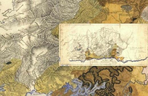
The department's collection of more than 500 heritage geological maps is in the process of being catalogued, conserved, scanned and archived. This page provides a selection of the most significant of these maps to view and download. As this page is developed, more detail will be available on the significance of these maps and the geologists, surveyors and cartographers who created them. In the future high quality copies of these maps will also be available for purchase.
A unique collection of over 800 geologically notated parish maps is also being captured and a small sample is provided.
Distinguished heritage maps
- Early Example of Original Geology Depicted on a County Map - 1882
- Geological Map of the Forest Reef Gold Fields - 1881
- County of Clarke, Eastern Division NSW (with Original Geology) - 1893
- Geological Map Wollongong Sheet SI5609, 1:253 440, 4 Mile Geological Series, first edition, 1952
- Geological Map at Marangaroo - 1901
- Geological Map of Broken Hill - 1893
- Geological Map of Broken Hill - 1921
- Geological Map of De Bavay Fault area, Broken Hill - 1922
- Geological Map of Forbes - Parkes Gold Field, 1910
- Geological Map of Hill End and Tambaroora Goldfield - 1918
- Geological Map of Hill End and Tambaroora, NSW, 1879
- Geological Map of Joadja - 1902
- Geological Map of New South Wales - 1893
- Geological Map of New South Wales - 1908
- Geological Map of New South Wales - 1914
- Geological Map of Portion of Broken Hill District - 1922
- Geological Map of Portion of the Southern Coalfield - 1914
- Geological Map of South Coast NSW - 1912
- Geological Map of Stanniferous Leads - 1895
- Geological Map of Sydney - 1903
- Geological Map of Vegetable Creek, Tin Mining District - 1910
- Geological Map of Wyalong Gold Field - 1899
- Geological Map of part of the Murrumbidgee River - 1908
- Geological Map of the Blue Mountains - 1909
- Geological Map of the Broken Hill Basin - 1922
- Geological Map of the Broken Hill District, 1950
- Geological Map of the Broken Hill Lode - 1922
- Geological Map of the Bulli - Mount Kembla District - 1912
- Geological Map of the Capertee and Wolgan Valleys - 1901
- Geological Map of the Central Illawarra District - 1906
- Geological Map of the Clarence Region - 1944
- Geological Map of the Elrington Gold Field - 1892
- Geological Map of the Gerringong District - 1905
- Geological Map of the Greta-Cessnock Coalfield - 1927
- Geological Map of the Gulgong Goldfield - 1937
- Geological Map of the Helensburgh - Bulli District - 1913
- Geological Map of the Lachlan Region, 1945
- Geological Map of the Macquarie Region, 1944
- Geological Map of the Maitland Coalfield - 1902
- Geological Map of the Monaro - South Coast Region, 1945
- Geological Map of the Murrurundi - 1902
- Geological Map of the Namoi Region, 1944
- Geological Map of the Pinnacles, Broken Hill Region - 1920
- Geological Map of the Richmond-Tweed Region, 1944
- Geological Map of the Robertson District - 1912
- Geological Map of the Sisters Lode, Broken Hill - 1922
- Geological Map of the Sydney District - 1925
- Geological Map of the Tin-Bearing District near Tingha - 1910
- Geological map of Hartley-Bowenfells-Wallerwang and Rydal, 1875
- Geological sketch map of NSW, 1880
- Local Geological Map, Parish of Parkes - 1890
- Map of Oxley Region Showing Geological Formations and Mineral Deposits, 1945
- Map of Southern Tablelands Region Showing Geological Formations and Mineral Deposits, 1945
- Map of Sydney Region Showing Geological Formations and Mineral Deposits, 1946
- Map of Upper Murray Region Showing Geological Formations and Mineral Deposits, 1944
- Map of the Colony of New South Wales - 1834
- Murrumbidgee Region Map Showing Geological Formations and Mineral Deposits, 1945
- New England Region Map Showing Geological Formations and Mineral Deposits, 1945
- Newcastle Region Map Showing Geological Formations and Principal Collieries, 1945
- Newcastle Region Map Showing Geological Formations and Principal Collieries, second edition, 1951
- Plan Showing the Situation of Gold - 1823
- Plan of coal seams at Greta and section of the Great Seam, 1869
- Geological Sketch Map of New South Wales 2nd edition 1883
- Upper Hunter Region Map Showing Geological Formations and Mineral Deposits, 1945
- Chart of the Turon Gold Diggings, Sofala, Bathurst, 1851
Parish maps with added geological information
- County of Argyle, Parish of Bungonia
- County of Argyle, Parish of Inverary
- County of Argyle, Parish of Jerrara
- County of Argyle, Parish of Marulan
- County of Argyle, Parish of Mullengullenga
- County of Argyle, Parish of Mummell
- County of Argyle, Parish of Narrangarril
- County of Argyle, Parish of Pegar
- County of Argyle, Parish of Pomeroy
- County of Ashburnham, Parish of Barrajin
- County of Ashburnham, Parish of Barton
- County of Ashburnham, Parish of Beargamil
- County of Ashburnham, Parish of Bell
- County of Ashburnham, Parish of Boree Cabonne
- County of Ashburnham, Parish of Brolgan
- County of Ashburnham, Parish of Canomodine
- County of Ashburnham, Parish of Cargo
- County of Ashburnham, Parish of Cumble
- County of Ashburnham, Parish of Goonumbla
- County of Ashburnham, Parish of Kamandra
- County of Ashburnham, Parish of Molong
- County of Ashburnham, Parish of Mugincoble
- County of Ashburnham, Parish of Parkes
- County of Ashburnham, Parish of Warregal
- County of Auckland, Parish of Gnupa
- County of Bathurst, Parish of Anson
- County of Bathurst, Parish of Calvert
- County of Bathurst, Parish of Carlton
- County of Bathurst, Parish of Chaucer
- County of Bathurst, Parish of Cole
- County of Bathurst, Parish of Errol
- County of Bathurst, Parish of Kenilworth
- County of Bathurst, Parish of Lindsay
- County of Bathurst, Parish of Lowry
- County of Bathurst, Parish of Malongulli
- County of Bathurst, Parish of Napier
- County of Bathurst, Parish of Neville
- County of Bathurst, Parish of Oakley
- County of Bathurst, Parish of Osborne
- County of Bathurst, Parish of Somers
- County of Bathurst, Parish of Three Brothers
- County of Bathurst, Parish of Torrens
- County of Bathurst, Parish of Vittoria
- County of Bathurst, Parish of Waldegrave
- County of Beresford, Parish of Coolringdon
- County of Brisbane, Parish of Brogheda
- County of Buller, Parish of Robertson
- County of Camden, Parish of Kiama
- County of Clarence, Parish of Canoulam
- County of Dampier, Parish of Moruya
- County of Ewenmar, Parish of Eura
- County of Forbes, Parish of Melyra
- County of Georgiana, Parish of Tuena
- County of Gowen, Parish of Gowang
- County of Gowen, Parish of Uargon
- County of Jamison, Parish of Doyle
- County of Leichhardt, Parish of Narratigah
- County of Murchison, Parish of Bingara
- County of Nadewar, Parish of Killarney
- County of Napier, Parish of Narangarie
- County of Northumberland, Parish of Newcastle
- County of Parry, Parish of Somerton
- County of Pottinger, Parish of Bando
- County of Raleigh, Parish of Herborn
- County of Rous, Parish of Tunstall
- County of Roxburgh, Parish of Morundurey
- County of Selwyn, Parish of Manjar
- County of Tongowoko
- County of Vernon, Parish of Walcha
- County of Wallace, Parish of Popong
- County of Wellesley, Parish of Currawong
- County of Wellington, Parish of Cooper